This was supposed to be a park

In 1940 the city opened this road as part of a park.1 Parkways then were for “pleasure vehicles.”2 Today it is a highway, and the park lives beside it.

Proposal Park from the bridge to the ferry pier at 69th Street. Walking, bicycles and park vehicles only, with no through traffic. No scheduled bus runs on this stretch today.3 The bridge approaches stay.
RoadAbout 16.5 acres of pavement.4
Crashes184 since 2021, injuring 175 people and killing 3.5
NeighborsAbout 35,300 people within half a mile, and 92,800 within a mile.6
CostThe Belt’s only expressway link to the Gowanus in south Brooklyn.7 What drivers would do

Read on

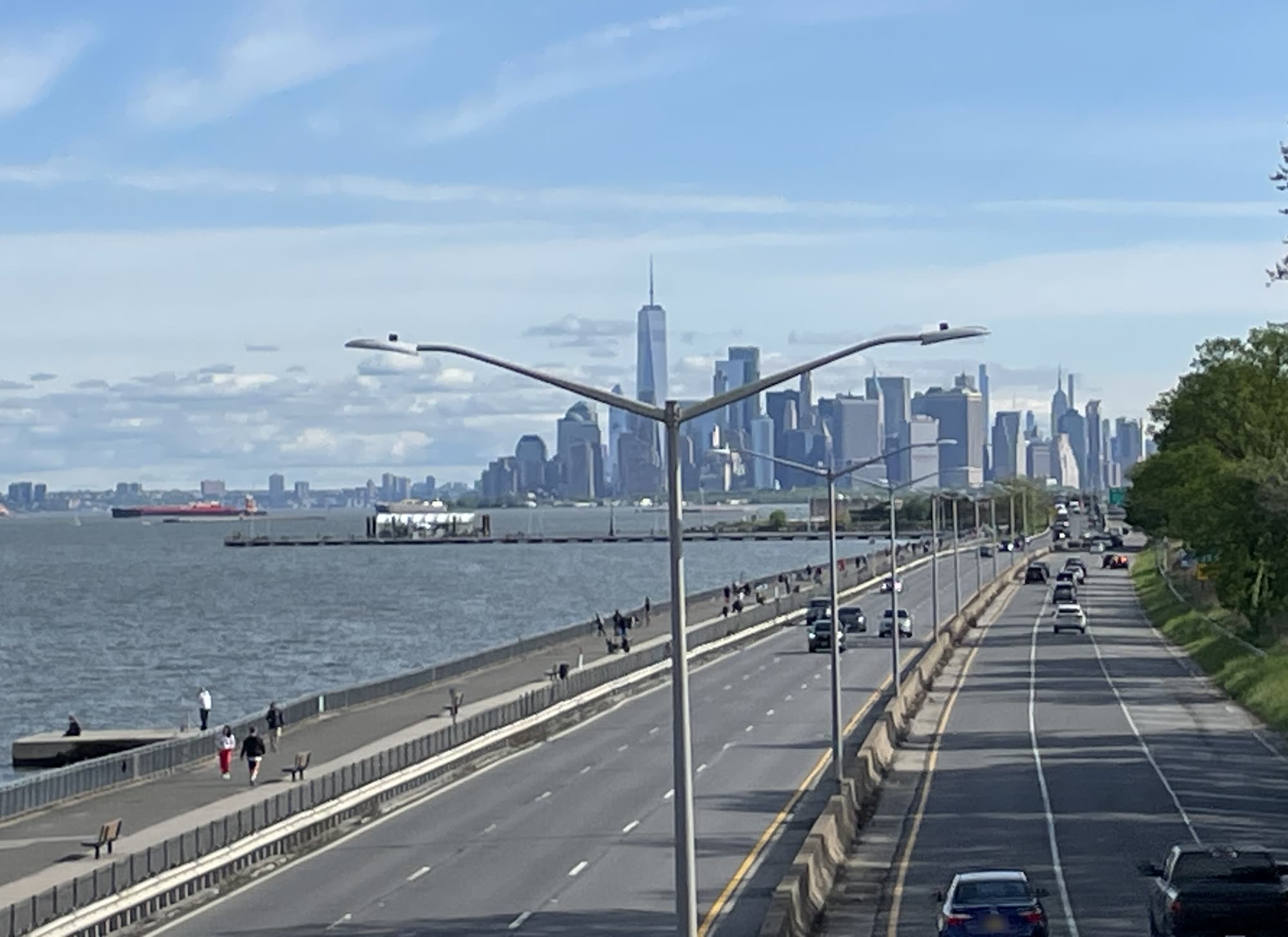
The Belt Parkway seen from above, with two wide roadbeds running north beside a narrow waterfront path, the Narrows on the left and Lower Manhattan ahead.

History

The park the city promised

The city made this shore for a park. By 1940 it had built a sea wall out in the Narrows and pumped sand behind it, “thus manufacturing new land for recreation purposes.”8 The Belt Parkway opened along it on 29 June 1940, as part of that park.1

“A continuous park system, not merely an automobile artery, a system of shoestring parks and recreational facilities encircling the entire metropolis”Robert Moses, Parks Commissioner, as quoted on a Parks sign in Shore Road Park.9

Bay Ridge was promised a waterfront park like Riverside Park in Manhattan.8

Today

Bay Ridge, cut off from its bay

An aerial photo of Bay Ridge seen from the water, with the strip between the Narrows and Shore Road in color, running two miles from the ferry pier to the Verrazzano-Narrows Bridge.
The same photo with the road's pavement painted red along the whole strip.
The wide photo with two lines. The Gowanus Expressway inland carries about 109,700 vehicles a day, trucks allowed. The Belt along the water carries about 55,700, no trucks. Yellow dots along the Belt mark 184 police-reported crashes since 2021, sized by how many share one mapped point. Starburst stickers mark the three crashes that killed people, one person each in October 2021, September 2024 and January 2026.
Four crossings along the road. Bay Ridge Avenue passes under it. The crossings near 81st Street and at 92nd Street have stairs. 4th Avenue has ramps. The two step-free crossings are about two miles apart.

This is the Bay Ridge waterfront, two miles from the ferry pier to the bridge.10 Most of it is Shore Road Park.11 Zoning marks the rest, the road, as park too.12

About 16.5 acres of it is highway.4 The road cuts the park in two. Playgrounds and ball fields sit on one side.13,11 On the other, the strip left by the water is about 70 to 80 feet wide at most sections.7

About 55,700 vehicles a day use this part of the Belt.14 Since 2021, crashes here have killed 3 people.5

About 35,300 people live within half a mile.6 To reach the water, they climb 1940 footbridges8,15 or walk up to a mile to a crossing without steps.7

Playground in Shore Road Park. Saturday 19 April 2025, 11:22 am.16

Park

The same land, with the road taken out

One park instead of two halves would put the playgrounds, the lawns and the water on the same side. People already fish from the rail, walk and cycle here.16 Without the fence, the guardrail and the road, they could reach the water without crossing a highway or climbing a footbridge,15 and the shore would be quieter.

TodayA close aerial photo of one cut through the shore. Bars mark about 70 feet on the water side, about 80 feet of road and about 300 feet of inland strip up to Shore Road.
ParkThe same aerial with the road drawn as park: lawn, a band of native grass beside the waterfront walk, and young trees. One bar marks about 450 feet of park from the water to Shore Road.
From above. One cut through the shore, three quarters of a mile south of the pier.10
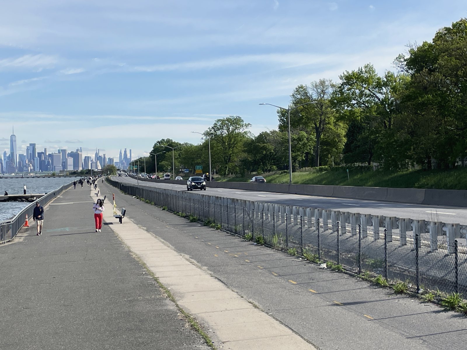
TodayThe view north from the waterfront walk: the walk and bike path on the left, then a chain-link fence, a guardrail and the road, with Shore Road Park's trees on the slope beyond and Lower Manhattan ahead.
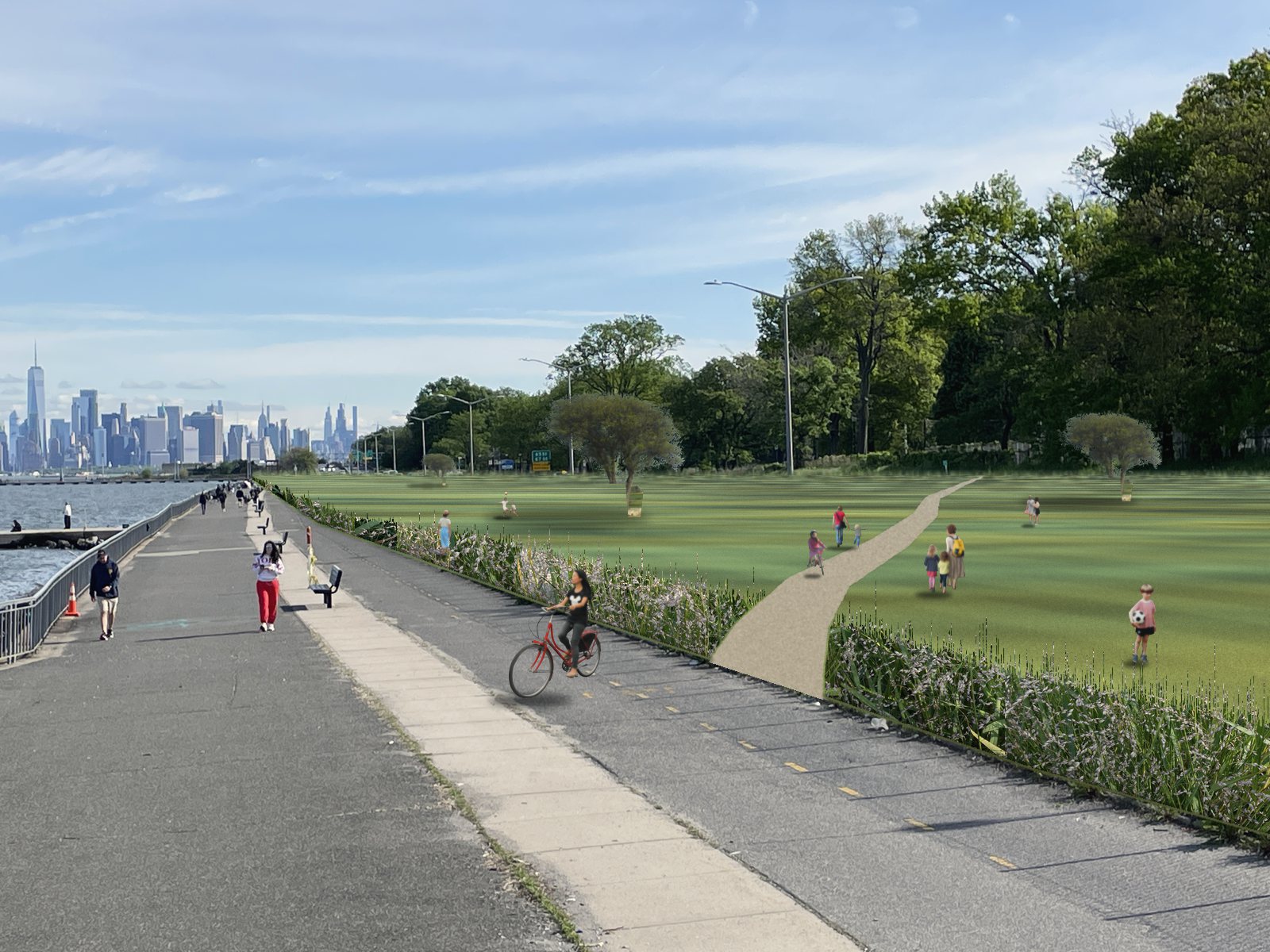
ParkThe same view with the fence, guardrail and road gone. A band of native switchgrass edges the bike path, and open lawn runs up to the slope, with young trees. A stone-dust path crosses from the bike path to the park. Families and children walk and play on the grass, and a cyclist rides the bike path.
On the ground. From the walk, the road sits behind a fence and a guardrail.16 The park view is a collage on the same photo, with no generated imagery.17

In Section

Taking the road out wouldn’t level the climb. Shore Road sits 18 to 73 feet above sea level, and at six of the eight sections measured the slope down is steeper than a ramp may be.18,15 Without a road in the way, a park would have room for gentler paths up the slope.

Today

A cut through the shore, drawn to scale. From the left: the Narrows, a railing, a wide walk with people and a bench, a two-way bike path, a chain-link fence and guardrail, then two roadbeds of cars with a concrete barrier and a tall light pole between them. Faint rings of noise spread from the road. On the park side, another guardrail and chain-link fence, then Shore Road Park's lawn and trees rising inland.

Park

The same cut with the road, fences and guardrails gone. The walk and bike path stay. Where the road was, lawn and native planting run up to Shore Road Park: serviceberry, eastern red cedar and swamp white oak, with people walking, cycling and using a wheelchair.
The same cut, drawn to scale.4,7,19,20

New York already runs parks this way. Prospect Park and Central Park drives are closed to private cars and open to park and emergency vehicles.21,22 A park here would need what every park needs, someone to run it and a budget to keep it up.

Evidence

What the records show

Origins

The fill made room for the parkway and about 23 acres of new park between it and Shore Road.23,24 Much of the strip is fill, but not all of it. A 2005 report for NYC DOT reads the 92nd Street site as “at least in part an existing shore,” raised with debris and boulders.25

The opening announcement called the parkway “a narrow shoestring park.”1 The ribbon was cut in Bay Ridge, opposite Owl’s Head Park just north of 68th Street. The whole Belt Parkway cost $28 million to build. The city paid $16 million and a federal Public Works Administration grant paid $12 million.1 By 1942 the strip between Shore Road and the parkway held five playgrounds, two athletic fields, bicycle paths and promenades.13

Shore

The road takes about 75 to 90 feet of the 320 to 680 feet between the water and Shore Road.4,7 On the Parks property map, the land on both sides is one park. Parks calls it Shore Park and Parkway, and its own signs call it Shore Road Park. Parks lists it at 58 acres, with ball fields, courts, playgrounds, a dog run and the Narrows Botanical Gardens.26,11,9
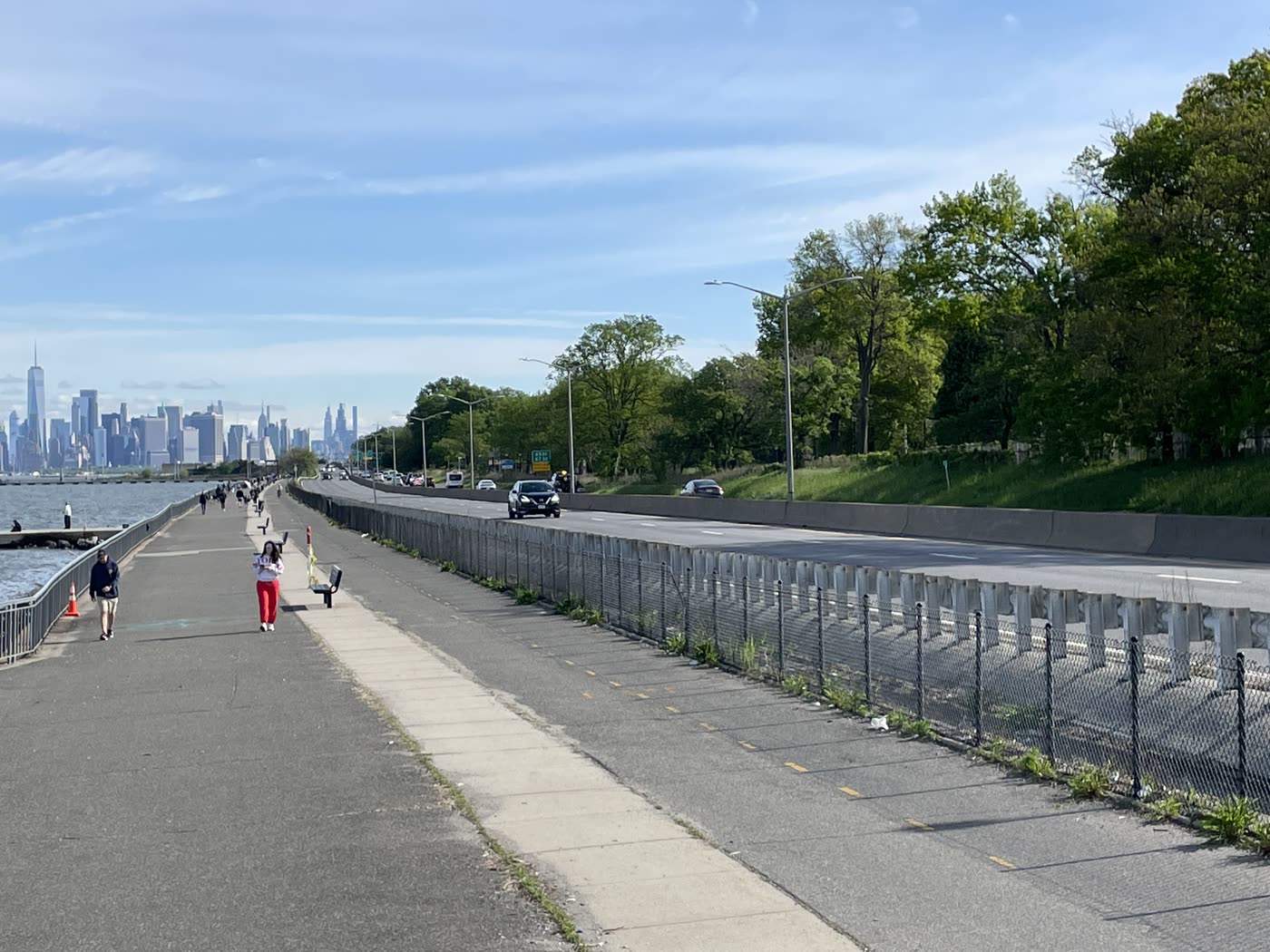
The waterfront path with walkers and a bench, the water and Lower Manhattan ahead on the left, and a fence with the road running beside it on the right.
Thursday 9 May 2024, 9:01 am. The path, with the road beside it.16
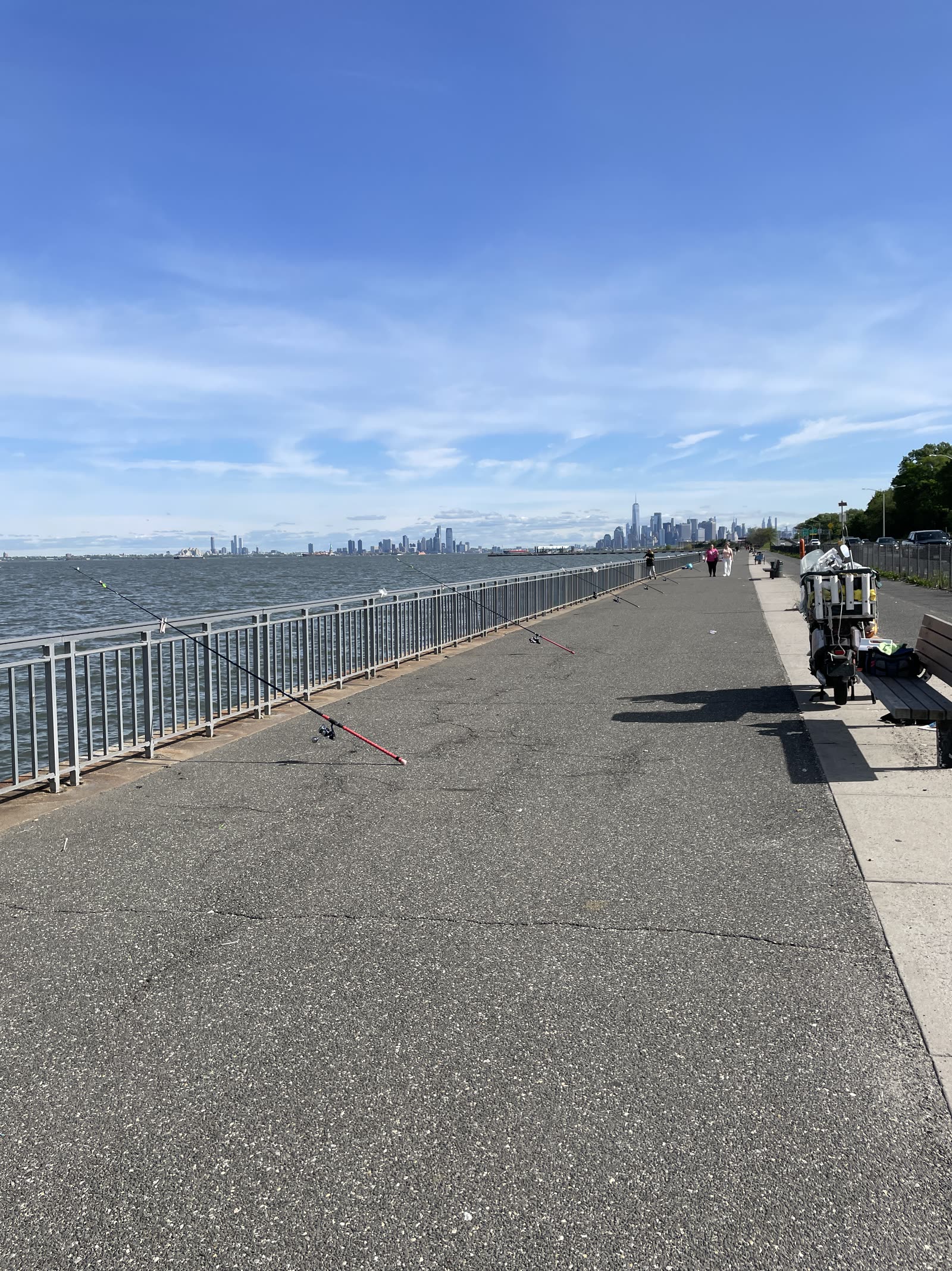
A wide stretch of paved path along a railing, with fishing rods leaning on the rail, a loaded cart by a bench and the skyline far off.
9:10 am. Fishing rods on the railing.16
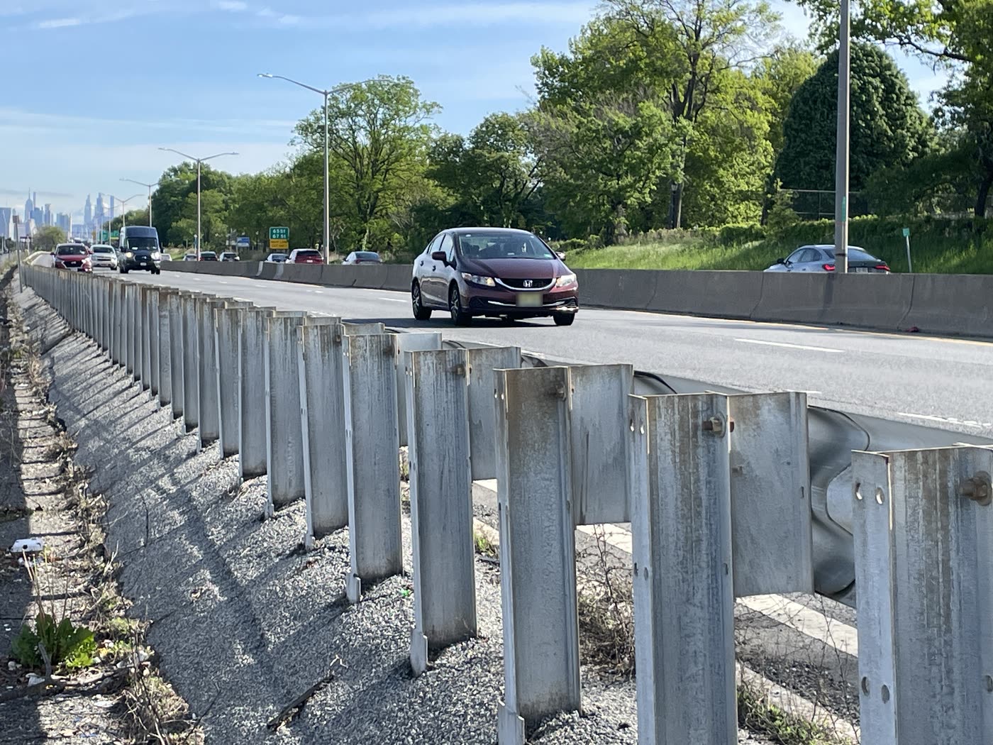
A rusting steel guardrail runs into the distance beside the road. A car passes close by, with trees and the Manhattan skyline behind.
9:03 am. The guardrail between the path and the road.16
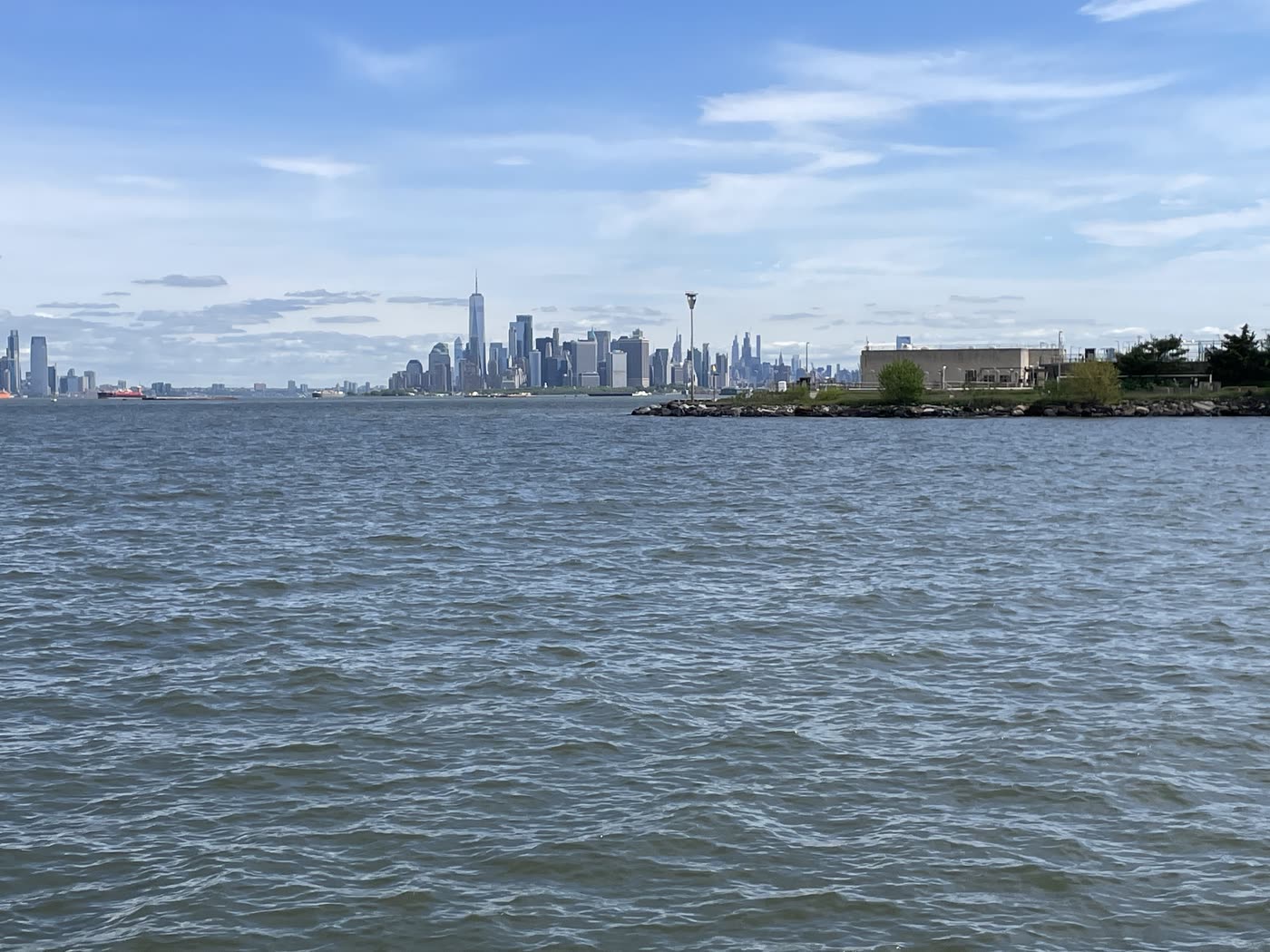
Open water with the skyline of Lower Manhattan on the horizon.
9:43 am. Looking north across the water.16
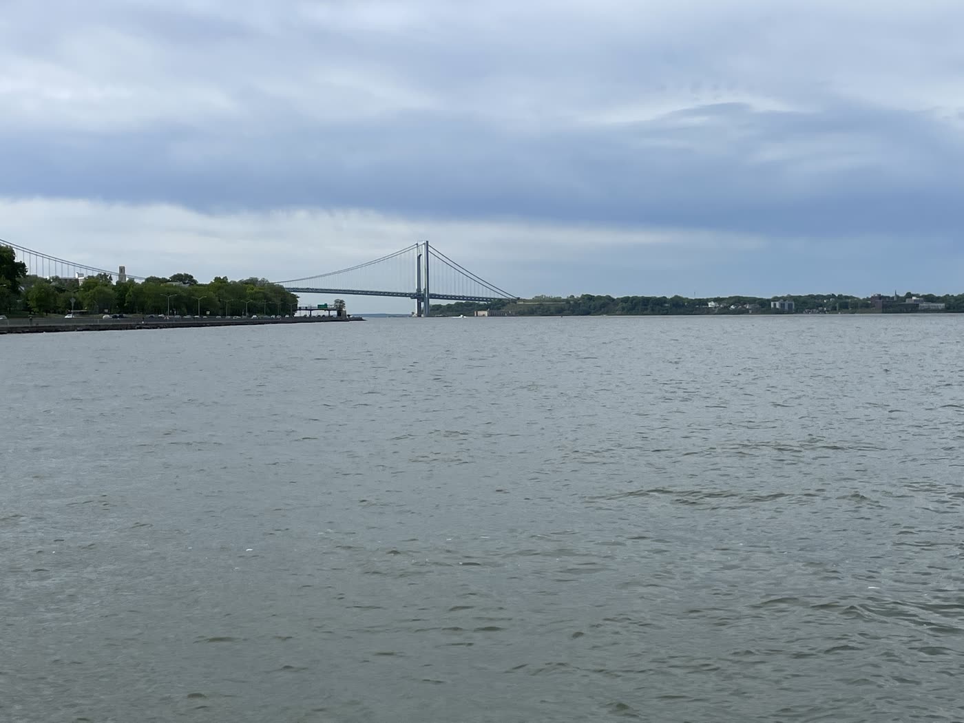
Gray water under a low sky, with the Verrazzano-Narrows Bridge beyond the shore.
9:44 am. The Verrazzano, looking south.16
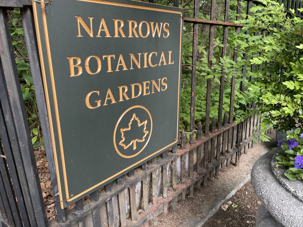
A green and gold Parks Department sign on an iron fence reads Narrows Botanical Gardens.
9:47 am. Narrows Botanical Gardens, one of the things Parks lists in the park.11,16

Crossings

To reach the water, people have to cross the road. There are four ways across, at the same places as in 1942.13,7

CrossingHow it crossesMiles from previous
Bay Ridge Avenue, at the ferry pierStreet under the parkway—
Old Glory Overlook, near 81st StreetFootbridge with steps, 19400.65
92nd StreetFootbridge with steps, 19400.66
4th AvenueFootbridge with ramps0.75

The two in the middle have stairs. A 2024 City Comptroller audit found two footbridges in this park with steps that don’t meet current ADA standards, most likely these two. It also listed corroded railings at both and holes in the girders of one.15,8

The step-free crossings sit at the two ends, about two miles apart. Someone at 86th Street who can’t use stairs walks about a mile to reach either one.7,27 Within half a mile of the road, about 14,600 people live more than half a mile from a step-free way across.6

Traffic

Commercial vehicles are barred, with some exceptions by permit.28,29 In 1942 the elevated Gowanus link was also a parkway, “limited to passenger vehicles.”30 It later became part of I-278, now one of the city’s through truck routes.31 So the region already has its expressway, and this road remains from an earlier idea of what a parkway was for.

NYSDOT’s 55,700 a day comes from a 2018 count adjusted for growth.14,32 The Gowanus Expressway, half a mile to a mile inland, carries about 109,700.7,14 The road is busy, so the case rests on what the land is worth, not on empty lanes.

Just north of the pier, at Exit 1, a crash on 25 August 2026 killed three teenagers.33

Land

The tax map puts the whole strip from the water to Shore Road, road included, in one lot listed under the Parks Department.34 Zoning marks it as park.12 The City Map labels it Belt Parkway, a mapped street more than 300 feet wide.35 The Parks property map leaves the road out, and NYC DOT does road work on the Belt.26,36 None of these is a title record. No private lot appears between the water and Shore Road at any section, so buying private land doesn’t look necessary there. Changes to the City Map go through the city’s public land use review.37

Cost

What the park would take

The main cost is one link. Without the waterfront stretch, trips between the Belt and the Gowanus would use local streets near 4th Avenue, a longer route east through Queens, or new ramps joining the Belt to I-278 at the Verrazzano.7 Nobody has counted how many drivers make this movement.

Trips betweenUse this stretch?Without it
The Belt to the east and the GowanusYesNo expressway link in south Brooklyn
Staten Island and the GowanusSome, by local streetsThe bridge route stays; the local route goes
Staten Island and the Belt to the eastNoUnchanged

No direct ramp links the bridge and the waterfront. Signs send some Staten Island trips between them by way of 4th Avenue and 92nd Street.7 The ramp onto the parkway at 4th Avenue heading north, the northbound exit to 65th and 67th Streets (Exit 1) and the southbound ramp from Ridge Boulevard would go.7

Verrazzano

The MTA is rebuilding the ramps between the bridge and the Belt under project VN-84B. Its November 2025 schedule planned ramp work to start in spring 2026 and the project to finish in late 2029.38 The proposal keeps the bridge approaches. Drivers heading west would leave the Belt at Exit 2, at 4th Avenue and Fort Hamilton Parkway, at the latest.7

Ferry Pier

The park ends at American Veterans Memorial Pier, the Bay Ridge ferry landing at 69th Street.39 The pier is reached from Bay Ridge Avenue, under the parkway. North of the pier the Belt runs about 0.4 miles to the Gowanus, and those 0.4 miles could stay road or end as a short road to the pier.7

Questions

What people ask

Where will the traffic go?

Some would move to the Gowanus and other roads, and some trips would change or stop. Where roads have been cut in other cities, less than half of the lost traffic showed up on other roads on average. That is a pattern from elsewhere, not a forecast for this road.40 When the city closed the Central Park and Prospect Park drives in stages in 2015, the mayor said it had been “pleasantly surprised that there haven’t been traffic impacts.”41

Won’t drivers just cut through the neighborhood?

Some would, mostly near the ramps at the two ends. Shore Road and nearby streets would need changes so the Gowanus stays the faster way.

Could we try it first?

Yes. Close the stretch to cars for a month in summer, and count traffic on the Gowanus and local streets before, during and after. Paris started its riverside park this way, closing an expressway for a month each summer from 2002 before closing it for good.42

I drive in from Long Island. What happens to me?

If you’re going to Staten Island, nothing. That trip doesn’t use this stretch, and the bridge approaches stay.7 If you’re heading for the Gowanus, you’d go through Queens or by local streets near 4th Avenue.7

What about people who have to drive to work?

Nobody loses their car. Drivers lose one two-mile link, and the Gowanus Expressway runs alongside it, half a mile to a mile inland.7,14 In Bay Ridge and Dyker Heights, nearly twice as many workers take transit as drive alone.43

How would ambulances get through?

The same way they do in Central Park and Prospect Park, where the drives stay open to emergency vehicles.21,22

Why this, when the park we have needs repairs?

The repairs come first, and they shouldn’t wait for this. Parks is already planning to rebuild the promenade, with more than $10 million in funding.44 While that work is underway, it’s a good time to ask what the whole shore should be.

Who would pay for it?

Nobody has priced it yet. Parks already runs the park on both sides of the road.11

Won’t a park attract traffic?

Not as much as a highway.

Would we build a highway here today?

If the answer is no, the next question is what this shore should be. This page is here to start that conversation.

Resources

Where cities have done this

In New York

  • Hudson River Park, Manhattan. The elevated West Side Highway collapsed in 1973, and the interstate planned to replace it was dropped in 1985. In 1998 the state made the shore a park.
  • Sheridan Boulevard, the Bronx. In 2019 the state turned about 1.3 miles of the Sheridan Expressway into a boulevard, with new crosswalks to Starlight and Concrete Plant parks.
  • Brooklyn Waterfront Greenway. A 29-mile route from Greenpoint to East New York, 22 miles of it built. It is planned to join the Shore Parkway Greenway in Bay Ridge.

Elsewhere

  • Harbor Drive, Portland. A six-lane waterfront highway, opened in 1950 and closed in 1974. Its land became a 37-acre waterfront park, now Tom McCall Waterfront Park.
  • Embarcadero Freeway, San Francisco. Damaged in the 1989 earthquake and taken down by 1991. A boulevard with a streetcar line and a waterfront promenade replaced it.
  • Cheonggye Freeway, Seoul. An elevated highway from 1968, taken down from 2003 to 2005 and replaced by a creek and a 9-kilometer green strip.
  • Madrid Río, Madrid. Part of the M-30 ring road along the Manzanares went underground, and a 10-kilometer park opened in its place in 2011.
  • Rives de Seine, Paris. A riverside expressway closed each summer from 2002, until the city approved closing it for good in 2012.

Under way and proposed

  • Interstate 81, Syracuse. New York State is taking down the elevated highway through the city center.
  • Freeways Without Futures. A list of city highways that would be better removed, published every two years since 2008 by the Congress for the New Urbanism.

Sources

Where every number comes from

  1. NYC Department of Parks. Press release, 27 June 1940. Transcription of the Municipal Archives scan.
  2. NYC Department of Parks. Statement on the 1938 parkway construction program, 10 February 1938. Transcription of the Municipal Archives scan.
  3. MTA. Bus schedule files (GTFS), the Brooklyn file linked here and the same set for the other boroughs and MTA Bus Company, service from 12 October 2026 to 2 January 2027. Route paths tested against OpenStreetMap; method in scripts/bus-routes.py. These list passenger trips only, so empty trips don’t appear. Bay Ridge-bound X27 and X37 buses use the Belt north of the pier.
  4. NYC Office of Technology and Innovation. Roadbed 2022. Brooklyn imagery from 16 and 30 March 2022. Acreage method in research/shore.md.
  5. NYPD. Motor Vehicle Collisions – Crashes, NYC Open Data. Police-reported crashes with a mapped point on the Belt between 4th Avenue and the ferry pier, 1 January 2021 to 22 October 2026. Retrieved 9 November 2026. Crashes without a location are left out, and so is one record placed on the stretch whose crash news reports place at Exit 1, near 65th Street (see the 25 August 2026 crash). 59 of the crashes, with 45 injuries and 1 death, are at the 4th Avenue interchange, whose bridge approaches stay, and 32 of those share one mapped point. Methods in scripts/crashes.py and scripts/crash-marks.py.
  6. U.S. Census Bureau. 2020 Census blocks, population. Retrieved 4 November 2026. Straight-line distances from the parkway; method in scripts/people-maps.py.
  7. OpenStreetMap contributors. OpenStreetMap, Belt Parkway ramps and crossings. Extracted 3 November 2026. Methods in research/road-users.md and research/crossings.md.
  8. NYC Department of Parks. Press release, 26 August 1940. Transcription of the Municipal Archives scan.
  9. NYC Parks. Vinland Playground, historical sign, Shore Park and Parkway. Retrieved 3 November 2026.
  10. New York State Office of Information Technology Services. NYS Orthos Online, latest imagery. Retrieved 5 November 2026. The colored road and paths are drawn from the city’s roadbed and OpenStreetMap lines; method in scripts/story-maps.py.
  11. NYC Parks. Shore Park and Parkway. Retrieved 3 November 2026.
  12. NYC Department of City Planning. Zoning districts. Retrieved 4 November 2026.
  13. NYC Department of Parks. Press release, 25 July 1942. Transcription of the Municipal Archives scan.
  14. NYSDOT. Annual average daily traffic, 2024–2025 geodatabase. Stations 20910 and 20901.
  15. NYC Comptroller. Audit of the maintenance of park bridges, Appendix 5, entries 4 and 5, and Appendix 7, entries 35 and 36. 28 June 2024.
  16. Photographs and video taken for this report. The clip’s location is from the phone’s GPS.
  17. Collage assets. Switchgrass: Jebulon, Wikimedia Commons, CC0. Tree: Gurpreet Singh, Wikimedia Commons, CC0. People: skalgubbar.se.
  18. USGS. Elevation Point Query Service. Queried 4 November 2026. Method in research/shore.md.
  19. NYC Office of Technology and Innovation. Street centerline. Retrieved 3 November 2026. Measurement method in research/transect-method.md.
  20. Streetmix. Illustrations, the people, bikes, cars, lamps and benches in the cross-section, adapted. CC BY-SA 4.0, so the cross-section is shared under the same license.
  21. Prospect Park Alliance. Park drive rules. 2023.
  22. Central Park Conservancy. Guide to the drives. Retrieved 3 November 2026.
  23. NYC Department of Parks. Press release, 7 June 1939. Transcription of the Municipal Archives scan.
  24. NYC Department of Parks. Press release, 4 December 1939. Transcription of the Municipal Archives scan.
  25. Joan H. Geismar. 1A Archaeological Assessment of Three Bridges, Shore (Belt) Parkway. Prepared for NYC DOT, March 2005.
  26. NYC Parks. Parks Properties, B082 and B166. Retrieved 4 November 2026. Not a title record.
  27. NYSDOT. Bridge conditions, BIN 2231249. Updated 5 October 2026.
  28. NYC DOT. Parkway restrictions. Retrieved 2 November 2026.
  29. NYC311. Truck or commercial vehicle permit. Retrieved 4 November 2026.
  30. Triborough Bridge Authority. Press release on the Gowanus Elevated Parkway, 5 May 1942. Transcription of the Municipal Archives scan.
  31. NYC DOT. New York City Truck Routes, NYC Open Data. The Gowanus Expressway is listed as a through truck route under NYC DOT Traffic Rules, Section 4-13(e)(1). Retrieved 9 November 2026.
  32. NYSDOT. Count statistics field definitions.
  33. NY1. 3 teens dead, 4 injured in Belt Parkway crash in Bay Ridge. 26 August 2026. Police responded to Exit 1 on the eastbound Belt, near 65th Street, north of the pier. News 12, Fox 5 and NBC New York report the same place. The police record’s map point falls between 81st and 92nd Streets, so this page leaves the crash out of its counts.
  34. NYC Department of City Planning. MapPLUTO 26v2, tax lot 3061400001. Retrieved 4 November 2026. Method in research/land.md.
  35. NYC Department of City Planning. Digital City Map, street centerlines. Retrieved 4 November 2026.
  36. NYC DOT. Resurfacing of the westbound Belt Parkway, Rockaway Parkway to Flatbush Avenue. 30 September 2014.
  37. New York City Charter. Section 197-c, Uniform Land Use Review Procedure. Retrieved 4 November 2026.
  38. MTA and Brooklyn Community Board 10. VN-84B community presentation. 6 November 2025.
  39. NYC Ferry. South Brooklyn route. Retrieved 2 November 2026.
  40. Phil Goodwin, Carmen Hass-Klau and Sally Cairns. Evidence on the Effects of Road Capacity Reduction on Traffic Levels. About 1998. Retrieved 6 November 2026. The authors warn against using their averages as a rule of thumb, and note that some traffic reappeared on more distant streets.
  41. Ben Fried. De Blasio Gets More Cars Out of Central Park and Prospect Park. Streetsblog NYC, 18 June 2015.
  42. Congress for the New Urbanism. Pompidou Expressway replaced with pedestrian zone. Retrieved 9 November 2026. Month-long summer closures ran from 2002 to 2010; the permanent closure was approved in 2012.
  43. U.S. Census Bureau. American Community Survey 2020–2024 5-year estimates, tables B08301 and B08201, Brooklyn Community District 10 (Bay Ridge and Dyker Heights). Covers residents of the whole district, not drivers on this road. Method in scripts/commute-by-district.py.
  44. NYC Parks. Shore Park Parkway Promenade and 4th Avenue Entrance Greenway Reconstruction, capital project tracker. Retrieved 3 November 2026.